
Mapping South Africa's population with GIS data
The Penn Libraries have acquired the South Africa 2011 Census Data Collection. This GIS data product offers detailed aggregate tables on South Africa's population from its 2011 Census with geographic querying and visualization capabilities.
tions.
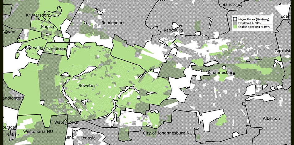
The South Africa 2011 Census Data Collection reports on 907 census data variables from 77 published tables, covering demographic, economic, housing, social, migration, and transportation topics for individual persons and households. These data variables are aggregated for 84,907 Small Areas covering the whole country. Geographic coding permits aggregating the data variables for higher-level geographies, including Municipalities, Districts, and Provinces.
Data in the South Africa 2011 Census Data Collection are presented in six ArcGIS shapefiles that can be displayed and analyzed using geographic information systems applications such as ArcGIS and QGIS. The census data variables are provided as attributes for the shapefiles. An ArcGIS geodatabase version of the data product is also provided.
This GIS data product has been developed by East View Geospatial using data from the South Africa 2011 Census published by Statistics South Africa, as one of East View's GIS Census Collection product series.
Explore this resource: South Africa 2011 Census Data Collection
Date
August 21, 2021